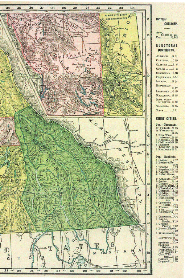
The Kootenays emerge as a Region.
One of the earliest printed maps 1895 (courtesy of the University of Texas), showing the Kootenay Region in the South-eastern corner of British Columbia in Canada.
This 1895 printed map has been developed from the hand drawn style of cartographic elements that have changed little since the middle of the eighteenth century, and the charting attributed to David Thompson is very much in evidence. The London Cartographer Aaron Arrowsmith, Purveyor of Maps to the World's established elite, copied David Thompson's 1818 map, even including a river that did not exist that Thompson had included in his version sent to London. An expanded version of the official story can be read in Barbara Belya's Columbia Journals and another perspective in Jack Nisbet's Mapmaker's Eye.
Below, Close-up identifying The Kootenays as an Electoral District.