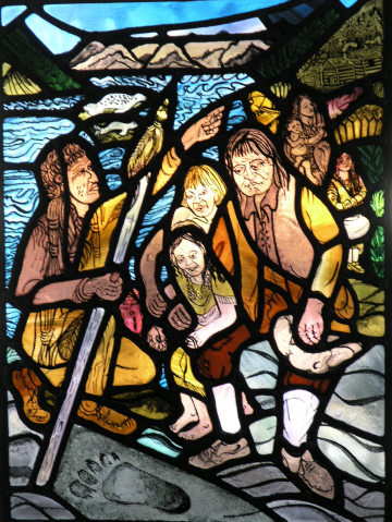

David Thompson in 1807, now a partner in the North West Company was authorised to prepare to cross the divide and establish trade in 'The Land of the Kutenais', his old employer the Hudson Bay Company was also making plans to cross the divide to trade.
The object of his quest - the headwaters of today's Columbia River was on his doorstep but he did not know it, having named the Columbia 'The Kootenae'.
The winter of 1807 was spent at Kootenae House, the trading post that the members of the expedition had built on Toby creek near present day Windermere Lake. Most of the time was spent trading and always staying alert in case of hostile attacks by the Peigans.
The exploration of "McGillivray's River " (Kootenay of today) was resumed in the Spring of 1808, when Thompson travelled down it through Tobacco Plains and then North past present day Creston up as far as a flooded area near Duck Lake where he met a group of 'Marsh Indians'.
Thompson spent a second winter at Kootenae House, trading, surveying and mapping the area. In June 1809, he went back east across the Pass and met it's namesake Joseph Howse who was exploring for the Hudson Bay Company.
Returning in the fall of 1809, Thompson travelled south on the present day Kootenay River to Bonner's Ferry, then crossing to the Pend Oreille into 'Flathead Country', follows a trail that brings him to the Spokane River. He establishes trading posts; Kullyspell House, Saleesh House, and then Flathead House in the fall, making short trips to familiarize himself with the lay of the land.
In the summer of 1810 David Thompson would make his last journey eastward over Howse Pass, which had now become a well-known route by the Peigans who blocked it, forcing David Thompson to consider looking for a northern pass for his next expedition to the 'Land of the Kutenais'.
In October of 1810, David Thompson, 23 men, 24 Horses and many wives, set out for the Athabasca Pass through which to avoid the Peigans, arriving at the end of December. The new year was spent crossing the divide, then travelling down the Wood River to the top of the bend (on the present day Columbia River) of the Kootenae River, wintering at a make-shift cabin the mouth of Canoe River.
By the spring the party has travelled South on the Kootenae (Columbia) River, crossed over to McGillivray's River, (Kootenay River) travels South on it, then by land to Flathead house, by canoe, and then on horseback to Spokane House and on to Kettle Falls on the Columbia River.

At the beginning of July 1811, they set out down the Columbia for the Pacific Ocean, reaching their destination on July 15th, to find that the Americans had already set up a post at Fort Astoria.
Returning back up the Columbia, Thompson plants a British Flag at the confluence of the Columbia and Snake Rivers and heads overland to Kettle Falls where on September 2nd, at 1pm, the party accompanied by eight canoes of 'Lakes Indians', they paddled upstream.
The next day they paddled against a strong current and camped 5 miles South of the mouth of the Pend d'Oreille.
On September 4th, 1811, they paddled in a swift current (crossing the border where the Waneta Dam is today), and at 6.10.pm. pitched camp at the mouth of Murphy Creek, North West of present day City of Trail.
At noon the next day they reached the mouth of McGillivray's River,(Kootenay River of today), the 'Lakes Indians' turned around a headed south down the Columbia River back to Kettle falls, Thompson's party pulled in at the site of present day Castlegar. Then heading up the Arrow lakes arrived at the site of Thompson's make-shift Cabin.
All of the pieces of the puzzle were finally in place!
Thompson's routes through the Columbia Basin would be used for many years by the fur companies, he crossed the Athabasca Pass for the last time in the summer of 1812.
He retired from the fur trade and moved with his family to Montreal. His map of North America was completed in in 1814, and he continued working as a surveyor, involving himself with Boundary issues and his books about his travels. He died in 1857, Charlotte who had given birth to 12 Thompson Children died 3 months later. They were together for 58 years and are buried in The Royal Cemetary in Montreal.
Compiled by Maureen A. Travers from the following source material:
David Thompson's Narrative of his explorations in Western America 1784-1812.ed. J. B. Tyrell. Available for reading online at the Champlain Society Website.
Barbara Belyea. - Columbia Journals - David Thompson. University of Washington Press.
Jack Nisbet. -The Mapmaker's Eye. David Thompson on the Columbia Plateau. WSU Press.